Land Survey Cost: 2026 Price Guide by Type

A land survey typically costs $400 to $1,200 for a straightforward residential boundary job. Topographic detail runs $500 to $1,500. ALTA/NSPS work on a commercial or complicated parcel costs $2,000 to $5,000 or more. Those are national ranges, not quotes — actual pricing swings by county, by surveyor, and by how messy the property’s history is. I’d treat any number you see online as a starting point for budgeting, then get two or three local quotes before you commit.
What actually drives the final bill: property size, terrain, how far out the land sits, which type of survey you’re ordering, and whether the existing boundary records are clean or a headache. A flat five-acre lot with a recorded deed and a prior survey on file is cheap and fast to re-survey. A twenty-acre parcel with overgrown fence lines, no recent survey, and neighbors who’ve never agreed on the corner pin location is a harder job. The surveyor will charge more for the extra work. I’ve seen rural buyers skip this step to save a few hundred dollars and then spend a lot more sorting out an encroachment after the fact.
Surveyors pull from county plat maps, prior surveys, and the recorded boundary records on file before they ever set foot on the property, so the condition of that paperwork matters more than people expect. Thin or outdated records mean more field time re-establishing corners from scratch, and that shows up in the price.
A survey isn’t just a formality for the loan file. A survey tells you exactly where your land starts and stops. It flags if your boundary overlaps with the neighbor’s land. It also confirms the acreage you’re buying matches what the listing says — and that’s worth checking on any raw land deal. If you’re weighing whether a piece of land is worth the money at all, that’s a separate question worth thinking through before you get to survey costs.
Related reading: Septic System Cost Raw Land – Why Testing Matters.
What Is a Land Survey?
A land survey is a licensed professional’s measurement of exactly where your property lines fall on the ground. It’s backed by legal description, deed research, and physical markers you can walk out and touch. It’s not a guess based on a fence line or what the neighbor told you. It’s math, legal records, and field measurements combined into one document that holds up if a boundary ever gets questioned.
Here’s how it actually works. A licensed surveyor pulls the recorded deed, the legal description, and any prior plats or surveys on file at the county. The surveyor goes to the property with GPS units, total stations, and sometimes a drone for big or rough tracts. They find the actual corners by locating existing iron pins and monuments or setting new ones. The surveyor checks everything against the official legal description on record. They note any mismatches, which happen often on older rural land. Then they make a signed, sealed map that shows your boundaries, acreage, and any easements or encroachments they find.
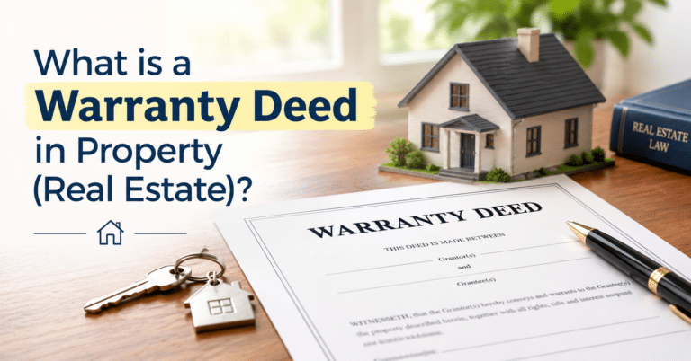
That plat is the useful part. You’ll want it on hand before you build anything near a property line, before you put up a fence, before you sign off on a warranty deed for a purchase, and anytime you’re dividing inherited land among family. I’ve seen deals stall for weeks because nobody could find an old survey and the title company wanted one before closing — ask the seller up front whether a current survey exists, because reusing an existing one is almost always cheaper than starting from scratch. Most counties keep a copy on file with the recorder or surveyor’s office, which is worth checking before you pay for a new one.
How much does a land survey cost?
A standard boundary or residential survey usually runs $400 to $1,200, and a topographic or ALTA survey on a larger or commercial tract can run anywhere from $1,500 up to $5,000 or more. Where you land in that range depends less on the size of the parcel alone and more on how much the surveyor has to walk, research, and document to pin down your corners.
I’ve seen two five-acre lots quoted five hundred dollars apart because one had clean, recorded corners from a 1990s survey. The other one was only described by an old metes-and-bounds deed with no monuments left in the ground. That’s the part people miss when they just Google “land survey cost” and expect one flat number.
| Survey type | Typical cost range | Best for |
|---|---|---|
| Property line / boundary survey | $400 – $1,200 | Confirming corners before a fence, sale, or dispute |
| Topographic survey | $500 – $1,500 | Grading, drainage, and construction planning |
| Larger acreage / rural land, complex boundary | $1,000 – $2,500+ | Raw land with unclear or unrecorded lines |
| Commercial / ALTA-NSPS survey | $2,000 – $5,000+ | Commercial purchases, lender or title requirements |
Think of the quote as built from a handful of real cost drivers, not a single “per acre” rate:
- Perimeter, not just acreage. A long, skinny ten-acre rural lot with a mile of fence line costs more to survey than a square ten acres, because the crew has to physically locate every corner and run every boundary line.
- Record quality. If the county has a clean prior survey on file, or you can hand over an old plat and the deed, the surveyor spends less time in research and title work — and that savings usually shows up in the quote.
- Terrain and vegetation. Flat, mowed, easy-access land is quick. Wooded, brushy, steep, or swampy ground slows the crew down and adds hours, which is billed time either way.
- How many corners are missing. Rural and recreational land that’s changed hands a few times often has lost or buried monuments. Re-establishing a corner from old deed language is slower and pricier than confirming one that’s already marked.
- Distance from the surveyor’s office. Remote rural parcels, especially out-of-county ones, can carry a mobilization or travel charge on top of the base fee — worth asking about up front.
- Survey type. A simple boundary survey is the cheapest because it only answers “where are my lines.” Topographic and ALTA surveys add elevation data, improvements, easements, and title research, which is why they run two to four times higher.
One thing I’d push back on: don’t assume the cheapest quote is the better deal. A surveyor who skips researching adjoining deeds or doesn’t set physical monuments can hand you a map that looks fine on paper but won’t hold up if a neighbor ever disputes the line. For raw land you’re buying sight-unseen or financing, that’s exactly the kind of corner-cutting that comes back to bite you later — if you’re budgeting a survey into the overall cost of a land purchase, it’s worth reading up on land financing options so you know where survey fees fit alongside closing costs and down payment.
Types of Land Surveys and Their Cost
Not every survey does the same job, and that’s where a lot of buyers waste money—they order the wrong one. A fence survey won’t hold up in a title company’s eyes, and an ALTA survey is overkill for someone just wanting to know where to put a property line fence. Below is what each type actually covers and what it tends to run, so you can match the survey to the problem you’re actually solving instead of guessing.
| Survey Type | Typical Cost Range | What It’s For |
|---|---|---|
| Boundary Survey | $400 – $1,200 | Locating corners and lines; buying, selling, building |
| Property Line Survey | $400 – $800 | Fencing, driveways, edge-of-property improvements |
| Topographic Survey | $500 – $1,500 | Elevation, slope, drainage, and grading plans |
| Site Planning Survey | $500 – $1,200 | Early-stage building and road layout design |
| Mortgage/Title Survey | $300 – $700 | Confirming boundaries match the legal description before a loan closes |
| Fence Survey | $250 – $600 | Checking a fence sits on the actual property line |
| Construction Survey | $1,000 – $2,000 | Staking foundations, roads, and utilities during a build |
| As-Built Survey | $700 – $1,500 | Confirming a finished project matches approved plans |
| Subdivision Survey | $1,000 – $3,000+ | Splitting one parcel into multiple lots |
| Structural Survey | $800 – $2,000 | Inspecting building condition before purchase or renovation |
| Hydrographic Survey | $1,500 – $5,000+ | Mapping underwater depth and contours for docks or marine work |
| ALTA/NSPS Survey | $2,000 – $5,000+ | Commercial deals needing title, easement, and improvement detail |
These numbers are general ranges, not quotes—get the exact figure from a licensed surveyor in your county, since terrain, lot size, and local demand all move the price up or down.
Boundary Survey
A boundary survey defines the exact limits of your property, and for most raw land buyers, this is the only survey you actually need. It’s often done before buying or selling land, starting construction, or resolving a dispute with a neighbor who’s convinced his fence line is three feet further over than it is. Surveyors use GPS and total stations to locate your corners and lines, then set or confirm physical monuments. The property boundary survey cost typically runs $400 to $1,200, depending on lot size, how overgrown the land is, and whether old monuments can still be found.
Property Line Survey
A property line survey shows where your land begins and ends. It’s narrower in scope than a full boundary survey, but sometimes it’s really the same job with a different name. Ask what’s included before you assume it’s cheaper. It’s worth getting before putting up a fence, running a driveway, or building anything near the edge of your lot. The price usually falls between $400 and $800, based on terrain and how easy the land is to walk.
Topographic Survey
A topographic survey maps the natural and built features of the land—slopes, trees, drainage paths, existing structures. Engineers and architects lean on it for drainage, grading, and site design, and if you’re planning a build on raw land, especially anything on agricultural or sloped ground, this is usually the second survey you’ll need after boundary. Because of the extra fieldwork, the price is usually $500 to $1,500 depending on how much the land contours.
Construction Survey
A construction survey stakes out where a project actually goes on the ground—foundations, roads, utility lines—and confirms elevations as the build progresses. It’s not a one-time visit; a builder may call the surveyor back out at several stages. Costs usually run $1,000 to $2,000, depending on project size and how many return trips are needed.
Subdivision Survey
A subdivision survey happens when a larger parcel gets split into smaller lots for sale or development. It has to meet county zoning and recording standards before the new parcels can be deeded separately. Expect this one to cost more the more lots you’re creating—prices typically start around $1,000 and can go past $3,000 for anything with several new parcels.
Fence Survey
A fence survey checks whether an existing or planned fence actually sits inside your boundary. Get one before installation, not after—moving a fence that’s already in the ground costs a lot more than the survey would have. Typical cost runs $250 to $600 depending on property size and how many corners need checking.
ALTA/NSPS Survey
An ALTA/NSPS survey is the most detailed survey on this list, built for commercial transactions and title insurance purposes. It covers boundary lines, easements, encroachments, and improvements, cross-referenced against the title commitment. Most land buyers don’t need a lender or title company survey unless one specifically requires it. You’re getting that survey because someone else’s underwriting demands it, not because your own due diligence calls for it. Prices run $2,000 to $5,000 or more given the extra legal and title work involved.
Mortgage or Title Survey
A mortgage survey confirms that boundaries and structures match the legal description before a loan closes. It’s a lighter-weight cousin of the ALTA survey, and lenders on conventional purchases often ask for one. If you’re weighing land financing options, it’s worth asking upfront whether the lender requires this survey, since it’s an extra line item on top of closing costs. Typical cost is $300 to $700.
Site Planning Survey
A site planning survey blends boundary and topographic data to support early building, road, or drainage design. It’s a planning tool more than a legal document, usually commissioned before anything gets permitted. Expect $500 to $1,200 depending on how much detail the planner needs.
As-Built Survey
An as-built survey verifies a finished project matches the approved plans—county permitting offices often require one before signing off on a certificate of occupancy. The average price runs $700 to $1,500 depending on the size and complexity of what got built.
Hydrographic Survey
A hydrographic survey maps underwater depth, shape, and current in lakes, rivers, or ponds. It matters for anyone planning a dock, bridge, or other marine work, and it’s specialized enough that not every land surveyor offers it—you may need to find someone who does this specifically. Costs run $1,500 to $5,000 or higher given the equipment involved.
Structural Survey
A structural survey looks at a building’s condition—walls, roof, foundation—rather than the land itself. It’s common before buying an improved property or starting a renovation, and it’s a different animal from the boundary and topographic surveys above; don’t confuse the two when you’re getting quotes. Cost usually falls between $800 and $2,000 depending on building size.
How to Save Money on a Land Survey
You don’t have to accept the first quote you get. I’ve seen the same boundary survey priced two different ways by two surveyors in the same county. One charged more because they had to drive farther, or they didn’t ask if an old survey already existed. A little prep work on your end usually knocks real money off the bill.
Start with your paperwork. If the land’s been surveyed before, dig up the old plat, deed, or any recorded survey from the county recorder’s office and hand it over. A surveyor who can start from existing monuments and recorded corners spends less time in the field than one starting from scratch, and that time is what you’re paying for. This matters even more on rural acreage where the last survey might be decades old but the corners are still good.
Next, be honest with yourself about what you actually need. A lot of people call up and ask for an ALTA survey when a plain boundary survey would settle the question just fine. If you’re putting up a fence or confirming a property line before you buy, you don’t need elevation data, drainage contours, or a title-insurance-grade report. Figure out the actual purpose first, then ask the surveyor which type matches it. Paying for more detail than the situation calls for is the single most common way people overspend here.
A few other things that genuinely move the price:
- Get at least two or three quotes, and ask each surveyor exactly what’s included — number of corners marked, whether you get a stamped drawing, how many site visits. Price without a clear scope isn’t a real comparison.
- Clear the ground before they show up. Brush, fencing, tall grass, and junk piled near the boundary all slow a crew down, and you’re billed for that time either way.
- Bundle services if you need more than one type of survey. Asking for a boundary and topographic survey on the same visit usually costs less than ordering them weeks apart, since the crew is already set up on-site.
- Avoid peak season if your timeline allows it. Surveyors tend to be stacked up in spring and summer; a fall or winter booking can mean more flexibility on price and a faster turnaround.
- Hire local. A surveyor based near your county already knows the recording office, the typical terrain, and often the neighboring parcels — that familiarity saves time, which saves you money.
Once the survey’s done, protect the investment. Keep the corner stakes or pins visible and don’t let mowing or construction crews knock them out — if you ever need a follow-up survey, those existing markers can cut the cost significantly. And ask for a digital copy of the final map, not just a printed one. It’s normally included at no extra charge and it’s what you’ll want on hand if you’re ever asked for proof of boundaries during a sale, a refinance, or a dispute with a neighbor. If you’re still weighing whether raw acreage makes sense for you at all, our guide on whether land is a good investment walks through the other costs worth budgeting for beyond the survey itself.
How to Hire a Professional Land Surveyor?
You want a surveyor who’s licensed in the state where the land sits, carries errors-and-omissions insurance, and has actually worked rural or vacant parcels if that’s what you own. A surveyor who mostly does subdivisions inside a city might not be the best fit for a 20-acre timber tract. Ask them directly how many rural boundary jobs they’ve done in the last year or two. Experience with your specific property type matters more than how polished their website looks.
Start by checking their license with your state’s surveying board — most states let you search online, and it takes two minutes. A valid license number doesn’t guarantee good work, but a surveyor who hesitates to give you one is a hard pass. I’d also ask who’s actually walking your property. Some firms send a licensed surveyor to stamp the final map but use an unlicensed crew for the fieldwork — that’s normal. But you want the licensed surveyor reviewing the data personally, not just signing off on someone else’s notes.
Get at least two or three quotes, and don’t just compare the bottom-line number. When you get a quote, ask if the corners will be marked with permanent iron pins instead of wooden stakes that rot or wash away. Find out if you’ll get both a paper plat and a digital file. Ask if the surveyor will record the survey with the county, which is standard in many places. A cheap quote that skips monument setting or leaves you with a hand-drawn sketch instead of a recordable plat isn’t actually cheaper once you factor in what you’ll pay to redo it.
Be specific about the survey type when you call. Tell them whether you need a boundary survey, a fence line check, a topographic survey for a build, or a mortgage survey for a lender. Vague requests get vague quotes, and surveyors sometimes pad the price to cover whatever you might need instead of just what you asked for. If the land is tied to a sale or refinance, the survey often needs to tie back to the legal description on the warranty deed — mention that upfront so they pull the right title records before showing up.
A few questions I’d ask before signing anything:
- Is your license active in this state, and can you give me the license number? Verify it yourself with the state board rather than taking their word for it.
- How many jobs like mine have you done recently? Rural acreage, waterfront, and land with old or conflicting deed descriptions all take different experience.
- What’s the turnaround time, and what happens if you find a boundary conflict? Good surveyors will tell you upfront how they handle discrepancies with a neighbor’s survey instead of burying it in the final report.
- What exactly do I get at the end? Ask for a recordable plat, physical corner monuments, and a digital copy — not just a verbal confirmation of where the lines fall.
- Do you carry E&O insurance? If their survey is wrong and it costs you money down the line, this is what protects you.
Once the survey’s done, don’t just file it away. Walk the property with the map in hand and check that the corner markers match what’s on paper. If something seems wrong like a fence in the wrong place or a marker that doesn’t match the neighbor’s corner, tell the surveyor before you close on the land. Also tell them before you get a building permit. Don’t wait until after.
Conclusion: How much Land survey Cost?
Budget $400 to $1,200 for a basic residential boundary survey. Push into topographic, construction, or ALTA/NSPS territory and you’re looking at $1,500 to $5,000 or more. Where your job lands in that range comes down to acreage, terrain, how clean the existing boundary records are, and how far the surveyor has to drive to reach you.
Here’s the part that doesn’t get said enough: if you’re buying raw or rural acreage through owner financing instead of a bank loan, nobody is going to require a survey before you close. Lenders usually insist on one. A private seller selling on contract often won’t. That makes skipping it tempting when you’re already stretching to cover a down payment. I wouldn’t skip a survey on anything with an old metes-and-bounds description. Don’t skip it if a fence line doesn’t match the plat. And don’t skip it if a neighbor has clearly been mowing or farming part of your parcel for years. A few hundred dollars now is a lot cheaper than finding out after closing that your well or driveway sits on someone else’s ground.
If the cost is the real obstacle, don’t solve it by skipping the survey — solve it by scoping it down. A plain boundary survey on flat, accessible land with decent prior records runs a fraction of what a full ALTA survey costs, and for most people buying a residential or recreational lot, that’s all you actually need. If you’re still sorting out how down payments, monthly terms, and deed transfer work on an owner-financed purchase, our Frequently Asked Questions page walks through the basics before you get to the survey stage.
Further reading
Frequently Asked Questions
How much does a basic land survey cost?+
A straightforward residential boundary survey typically costs $400 to $1,200. The final price depends on property size, terrain, how remote the land is, the survey type you need, and whether the existing boundary records are in good shape or need extra work to sort out.
What's the difference between a boundary survey and a topographic survey cost?+
A boundary survey runs $400 to $1,200 for residential work, while a topographic survey costs $500 to $1,500 because it includes terrain detail. ALTA/NSPS surveys on commercial or complicated parcels go $2,000 to $5,000 or more due to the added complexity and requirements.
Why does a land survey cost more for some properties than others?+
Surveyors charge more when boundary records are old or incomplete, fence lines are overgrown, there's no recent prior survey on file, or neighbors disagree on corner locations. A clean, recorded deed with a prior survey already on file is cheap and fast; messy property history means extra field legwork and higher costs.
Can I reuse an old survey instead of ordering a new one?+
Yes — reusing an existing survey is almost always cheaper than starting from scratch. Before you pay for a new survey, ask the seller if a current one exists and check with your county recorder or surveyor's office, where most counties keep copies on file.
What is a land survey?+
A land survey is when a licensed surveyor measures your property's legal boundaries and physical features using GPS, lasers, and a total station. They turn all that into a map you can use for building, selling, or settling a dispute. It's the one document that tells you, officially, where your land actually starts and stops — not where you assume the fence line is.
How much does a land survey cost?+
Most residential boundary surveys run $400–$1,200. Topographic and commercial work, including ALTA/NSPS surveys, can run $1,500–$5,000 or more. The spread comes down to acreage, terrain, how recently the land was last surveyed, and how far the surveyor has to travel to reach it. A flat quarter-acre lot in a subdivision with a survey on file is a quick job. Forty acres of brush with no recorded corners is a different project entirely, and the quote will reflect that.
What factors affect the cost of a land survey?+
Size and terrain matter most — more acreage and rougher ground mean more field hours. The quality of existing records matters a lot. If the county has a clean prior survey on file, the surveyor can confirm corners faster. If they're starting from an old deed description with no monuments to find, it takes longer. Survey type changes the price too, since a simple boundary job and a full ALTA survey aren't the same scope of work. Dense brush, standing water, or poor road access will also push the bill up, because it slows the crew down.
What are the most common types of land surveys?+
Boundary, property line, topographic, construction, subdivision, and ALTA/NSPS surveys cover most of what buyers and builders need. A boundary survey just locates your corners and lines. A topographic survey adds elevation and land features for site planning. Construction and ALTA surveys go further still, tying in improvements, easements, and title details — which is why they cost more and take longer to turn around.
How much does a boundary survey cost?+
Expect $400–$1,200 for most residential lots. That price buys you confirmed corners and property lines, which is usually all you need before building a fence, settling a line dispute with a neighbor, or closing on a purchase. Cost climbs with acreage, irregular lot shape, and how hard the corners are to physically find.
What does a topographic survey cost?+
Budget $500–$1,500. A topo survey maps slope, elevation, trees, and existing structures — the data an architect or engineer needs before designing grading, drainage, or a foundation. It takes more field time than a basic boundary survey, which is reflected in the price.
Why is a land survey important?+
It's the only way to know, with legal certainty, what you actually own. A survey catches boundary overlaps and encroachments before they turn into disputes, confirms the acreage you're paying for matches the deed, and keeps a construction project from getting built partly on someone else's land. If you're buying raw land sight unseen or buying owner-financed, pairing a current survey with a clean warranty deed is how you protect yourself before money changes hands.
How can I save money on a land survey?+
Hand over any old survey, plat, or deed you have — it cuts down the surveyor's research time. Order only the survey type you actually need. Get two or three local quotes before you pick one. Clear brush and tall grass off the property line ahead of time. Small prep steps like these routinely shave real money off the final bill.
How do I hire a professional land surveyor?+
Confirm the surveyor is licensed in your state, has handled your property type before, and can show references from past work. Get written quotes from a few local firms, compare what's actually included, and be specific up front about whether you need a boundary, topographic, or ALTA survey — vague requests lead to inflated quotes. A surveyor based near your county will usually know local recording quirks that an out-of-area firm won't.
When should I get a land survey done?+
Before you buy, before you build, before you fence, and before you divide a parcel among heirs or buyers. If you're financing the purchase — including owner financing or a land loan — a current survey protects you the same way it would with a bank-financed deal, confirming the acreage and access match what's in the listing before you sign anything. Waiting until after a dispute or a construction mistake always costs more than ordering the survey up front.